Dogram has carried out in December 2014 the photogrammetric and topography survey of the current status of camarín de la Virgen, el zaguán, which provides access, and the dome and dome basement of Santuario de las Virtudes, project commissioned by the council of Santa Cruz de la Mudela, Ciudad Real.
These rooms show rich and diverse iconographic scenarios with several images from the Old Testament, Marian scenes, representation of the Christian virtuosity and several trompel’oeil from 1699, according to the inscription appearing on the stair. This survey was carried out in order to deliver documentation as trustable scientific reference of the appearance and status of the paintings, as preservation tool, and as digital database for the planning of future restauration projects, as well as for diffusion and publication, or even reproduction.

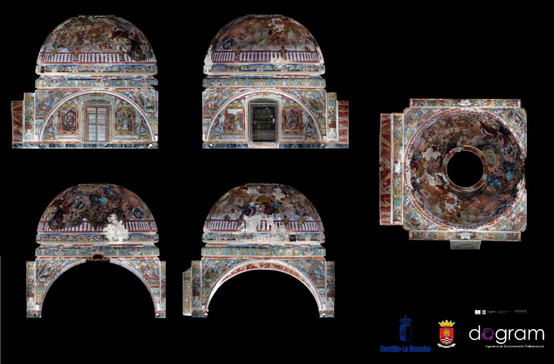
Ortofotografía de alta resolución de la bóveda del camarín de la Virgen en el Santuario de las Virtudes. Ciudad Real

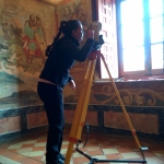
Imagen de campo durante el levantamiento topográfico
A photogrammetric documentation work has been carried out on the site, by taking several photos. Previously, we have worked out the suitable shot distance in order to achieve a detail level on the final ortophotos of 1 mm per pixel, suitable to be printed 1:5 scale and with a resolution of 127 dots per inch.
Regarding illumination, after a very comprehensive study, due to the geometric and mirror-image conditions of the materials and the status of the paintings, we have used controlled power non-polarized lighting, through flashes located in such way they allow to see the most natural appearance and let see all the details, avoiding the heating of the paintings through the emitted light, the loss of texture information due to the shadows, and the glows of the paintings´ materials.
A total of 1459 images were carried out from different angles with a coverage higher than 50%. For this purpose, a Canon EOS 600D camera with Canon EF 24mm f/1.4L II USM calibrated objective was used .
To avoid metric deviations and provide all the information regarding scales and verticality, a topographic survey was carried out through the high precision total station Topcon OS-103, with 2 mm +2ppm precision level. A supporting and control network was registered, through 63 points allocated uniformly over all the surfaces of the camarín y the altar dom. These have been situated through characteristics easy to be identified on the own facades. We have so avoided the use of adhesive targets, minimizing any risk of damage. This survey has been carried out with high precision, by placing 4 station during the miniprisma tasks.
In addition, 336 images of the landscape were done in order to prepare a 360º virtual tour to facilitate the access and cultural spreading, showing the richness of the paintings through the web digital contents
From this on site database we completed the work at the office, including the processing, 3D thick restitution, preparation of the graphic documentation of the current status through 12 orthophotos of elevation-section and 2 dome plants.

We must stress that our method do not deploy modified images or ideal plans or basic surfaces taken by just some handmade points, but our planimetric documentation is obtained always from volumetric reconstructions, thick texture photos, showing a high level of detail and resolution
Through our method all the orto-photos are strictly true and are obtained by the simple picking of the projection plans and the cutting on the 3D model. They are not idealized nor simplified during the projection

Miniaturas de las ortofotografías del camarin de la Virgen del Santuario de las Virtudes, Ciudad Real.

Miniaturas de las ortofotografías de alta resolución de la cúpula, lunetos y pechinas del Santuario de las Virtudes, Ciudad Real.
All this documentation is valid not only as technical information, but they add value to these magnificent paintings whose conservation and divulgation are ensured. In order to facilitate this, we have developed a high resolution virtual tour, whose sample you can see here.

