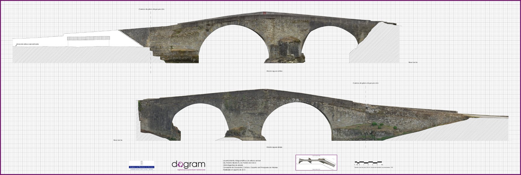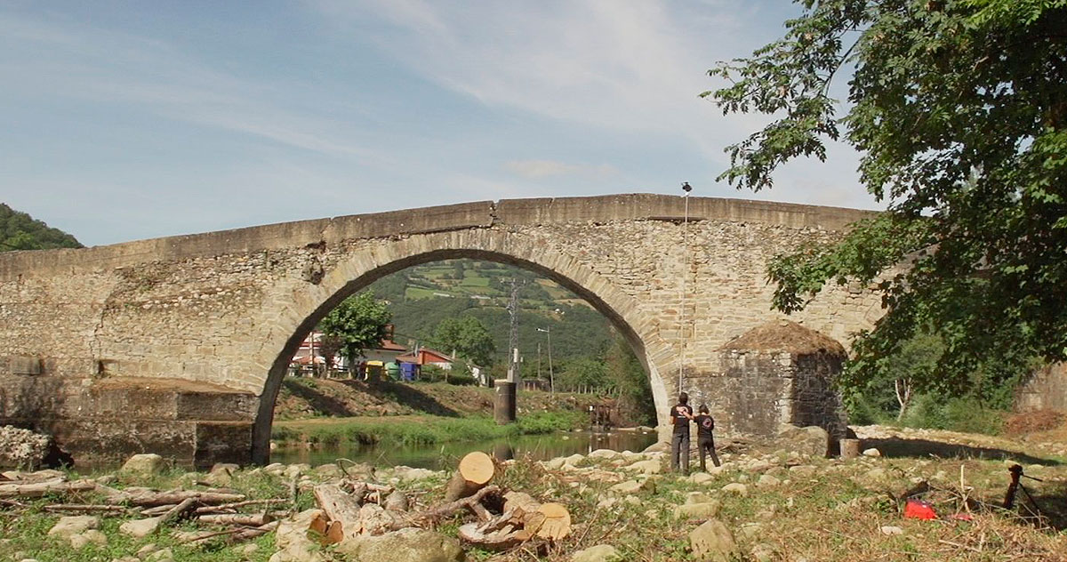
Previous study of the current state and it acts as a reliable document into the elaboration of the intervention project for its rebuilding. So, with the obtained photographs, it is possible to evaluate its state, look for cracks, create maps of pathologies, take measurements and calculate possible falls.

 We made a 3D photogrammetric survey with a level of detail equivalent to a 1:12 scale. Due to
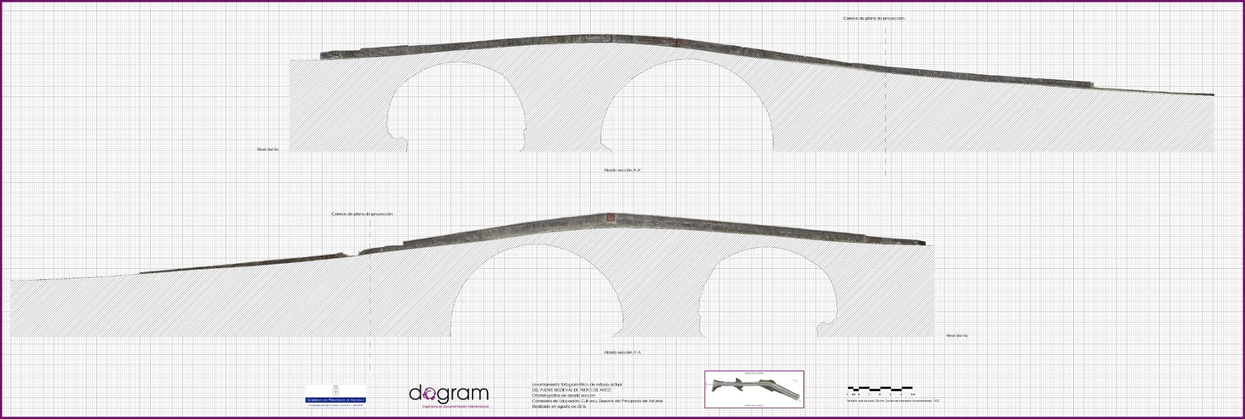
the length of the bridge, about 70 metres, the orthophotographs were made in a 1:50 and
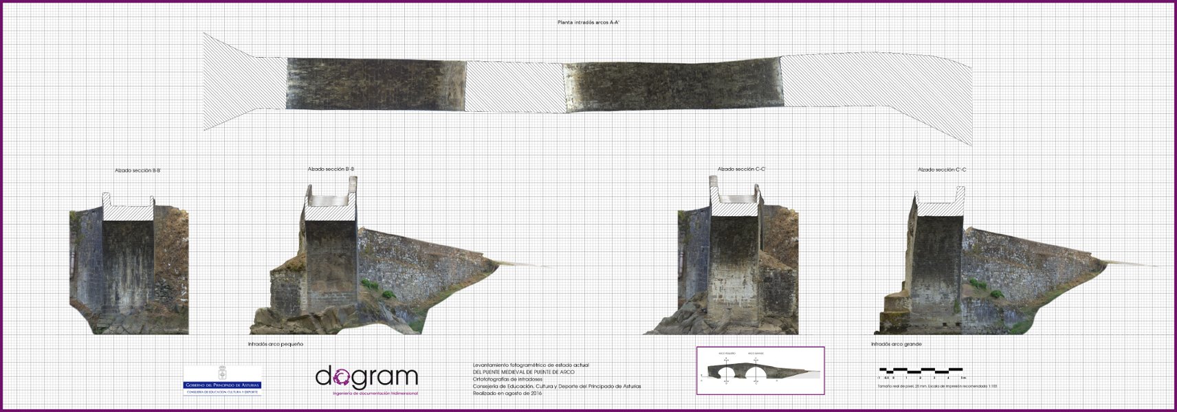
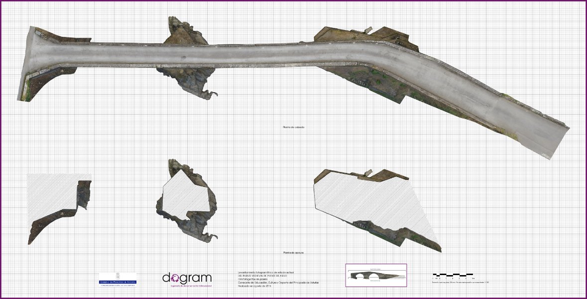
1:100 scale, obtaining: ground-floor plant, support plant, upriver survey, downriver survey,
profiles and plant from the jambs of the arcs and two longitudinal sections for the retaining walls.